MAPS AND GUIDES OF THE CLUB VOSGIEN DE LA VALLÉE DE MUNSTER
There are 3 different guides. Each guide contains 20 pocket-sized walking sheets. Each sheet contains a description of the walk, including duration, distance, altitude difference, points of interest, restaurant facilities, a map and profile of the route and a detailed itinerary:
Our latest walking guide includes 20 easy walks lasting 2 to 3 hours, with the route traced on the IGN base map. Guide N°2 includes 20 walks (from 2 hours 10 minutes to 7 hours) Guide No. 3 includes 11 easy walks (from 1 hour 05 minutes to 2 hours 15 minutes) and 9 hikes (from 2 hours 25 minutes to 6 hours).
They are available from the Tourist Office and local bookshops for €15 each.
Translated with DeepL.com (free version)
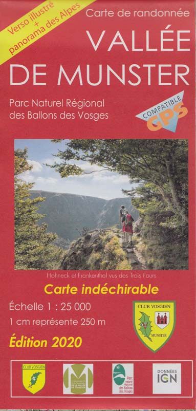
MAPS AND GUIDES OF THE CLUB VOSGIEN DE LA VALLÉE DE MUNSTER
This 1:25,000 scale IGN map lets you hike all over the valley, from Turckheim to Lac de Longemer, from Lac Blanc to Rouffach.
You won’t need 4 maps to cover 460km of signposted footpaths! On the back, you’ll find a tourist guide to the valley’s remarkable sites, flora and fauna. It is on sale for 16 euros from the Munster tourist office and bookshops in the region, or online from the Club Vosgien federation: https://www.club-vosgien.eu/boutique/cartes-de-randonnee/top-25-munster/
It has been updated with 175 changes corresponding to the surveys carried out during the digitisation of our trails, the updating of place names and changes to signposting (see below*). It is tear-proof.
Walking maps and guidebooks are on sale at the Tourist Office.
You can download the leaflets for our historical trails and the Alsatian poets’ trail by clicking on the links below:
* Why have we changed the waymarking on certain trails?
The latest edition of our “Vallée de Munster” IGN map has been updated with these markings, in line with our desire to make our markings as easy to understand as possible. Each of our hiking routes is marked by a single sign, which leads from the start to the final destination. When, at a fork in the trail, you come across an X-shaped marker (an easel), this indicates the possibility of joining another route or destination. La dernière édition de notre carte IGN « Vallée de Munster » est à jour avec ce balisage.